Big Country Neighborhood Association

  • Get Involved
    • Meetings & Membership
    • Big Country Book Club
    • Contribute to BCNA
  • Useful Information
    • Quick Reference List
    • Getting Online
      • Online Access
      • Satellite & Cable Providers
    • Service Referrals
      • Contractor References
      • Neighborhood Services
    • Big Country Living
      • Rainwater Harvesting
      • Managing Mosquitoes
      • Snakes
      • Oak Wilt
  • Neighborhood Safety
    • Order EMS Street Sign
    • Tips from EMS
    • Vial of Life Program
  • About BCNA
    • Who’s Who
    • Bylaws
    • Architectural Control Committee
    • Maps and Photos
    • Contact Us
You are here: Home / About BCNA / Maps and Photos

Maps and Photos

FEMA (Federal Emergency Management Agency) Flood Maps

The FEMA (flood) map for our neighborhood is available in two parts:

  • North map
  • South map

FEMA maps are a good starting point to determine the risk of flooding, but they are not 100% accurate for our area. This is because the FEMA models don’t capture adequately wet-weather creeks that are plentiful in the Hill Country. They are also limited in that they assume tree coverage that is unrealistic of a populated subdivision — as tree coverage is reduced in areas with little or no topsoil (e.g. removing cedar, without planting replacement trees; or building structures in previously treed areas), more water rushes into our creeks, increasing the width of flooding creeks.

Finally, for the more paranoid readers, those maps are based on historical data, and don’t take into account unprecedented weather patterns that may result from global warming (if you believe in it). So, in short, use your own observation skills to assess your level of flood risk for your present structures and future projects.

Aerial Photos

Aerial photos for our neighborhood (from 1996), with overlaid elevation contours at 10ft intervals, are available in two forms:

  • 2-D aerial
  • 3-D aerial

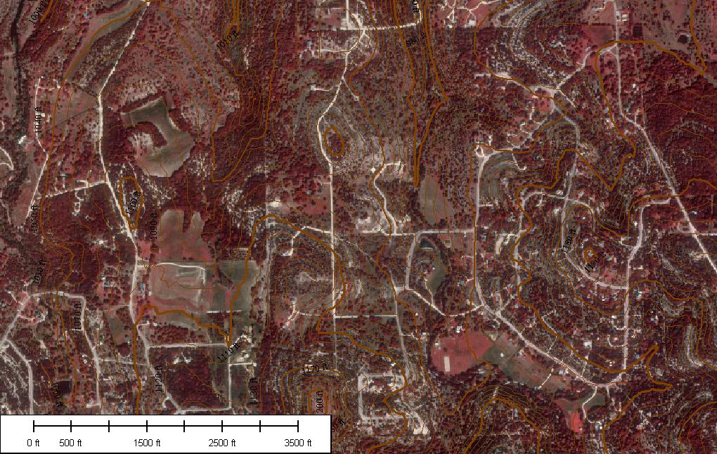
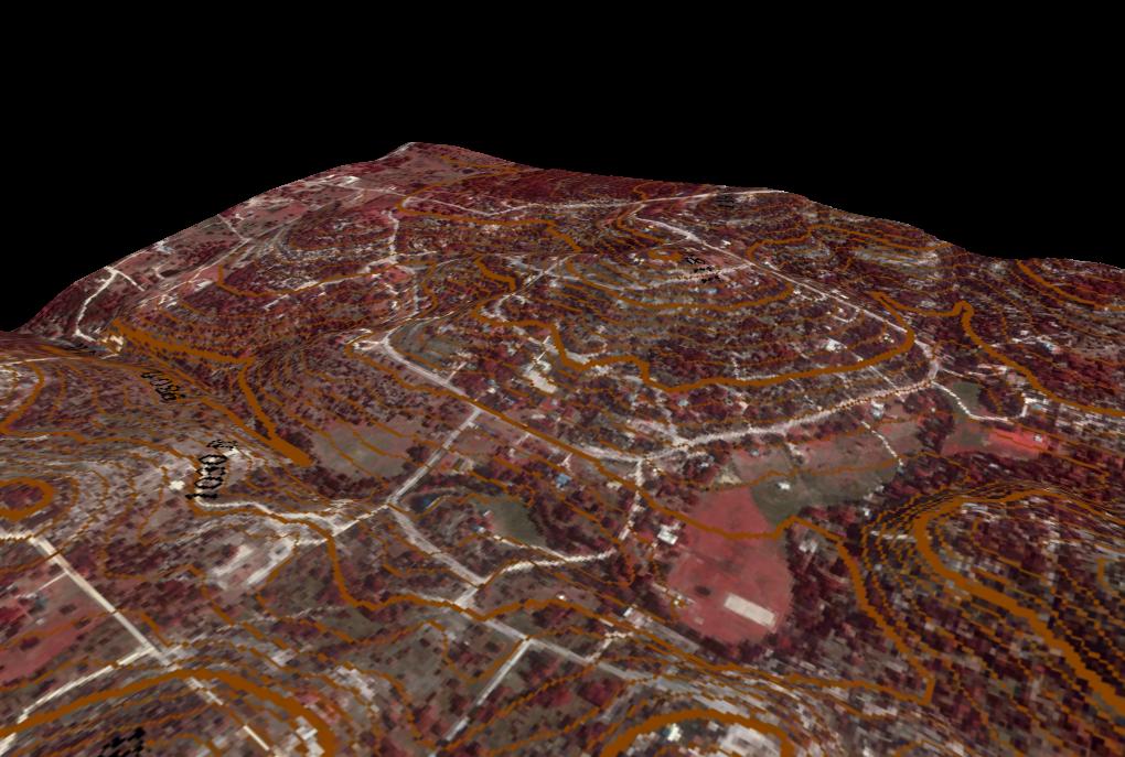
An additional photo, from around 2002, contains more recent features.

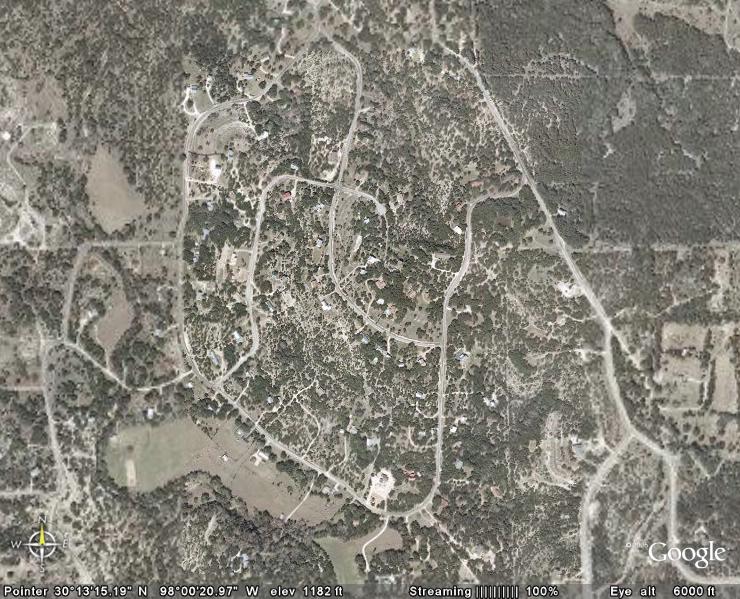
Additional Information

You can obtain more information about our area from the following sources:

  • Google Maps: aerial/satellite photos.
  • Google Earth: aerial/satellite photos and 3D maps; the free service is limited in resolution.
  • TerraServer: aerial/satellite photos; the free service is limited in resolution.
  • United States Department of Agriculture Geospatial Data Gateway: all sorts of information, including climate data, soil types, and more; but you have to download a viewer to analyze the data.
  • Texas Natural Resources Information System: like the previous site, but specific to Texas.

BCNA Happy Hour – March 1, 2024

Ladies' Night - Friday, March 1 @ 6:00 pm

Vasquez Residence
12591 Trail Driver

Happy Hour for mom’s/ladies of the neighborhood! (Adults only, please)

Stonewall Entry Cleanup – March 9, 2024

Saturday, March 9 @ 9:00 am

Sonewall Entry-can park in either driveway at 12591 Trail Driver if needed

Volunteer effort to cleanup dead plants at cattle guard entry

Annual BCNA Picnic & Meeting – April 20, 2024

Saturday, April 20 @ 2:00pm

The Cassell Property-Corner of Trail Driver and Paisano Trail

Recent Posts

  • Protected: BCNA Meeting Minutes – 1/20/2024 February 6, 2024
  • Protected: BCNA Minutes Draft – 10/19/2019 October 14, 2019
  • Protected: BCNA Minutes Draft – 07/28/2019 July 31, 2019
  • Protected: BCNA Meeting Minutes – 06/21/2019 July 15, 2019
  • Protected: BCNA Meeting Minutes – 03/14/2019 July 15, 2019

Post Categories

  • BCNA Meetings (41)
  • News (1)

Archives

Quick Links

  • Sitemap
  • Home
    • Get Involved
    • Useful Information
    • Neighborhood Safety
    • About BCNA
  • Contact Us

About BCNA

The Big Country Neighborhood Association was created to facilitate communication and strengthen community ties among our residents. BCNA-led activities include: maintaining this website and email list, quarterly meetings, and various social events.

The BCNA is volunteer-run, volunteer-funded, and participation is 100% voluntary.

Contribute to the BCNA

BCNA activities and events are made possible through the generosity of our neighbors. Your contribution helps make Big Country a better place for everyone.

Copyright © 2026 Big Country Neighborhood Association · Powered by Genesis Framework & WordPress

Terms of Use: Non-password-protected areas of this site are for general use. Access to password-protected areas is limited to residents of the Big Country subdivision. Email addresses, whether individual or mailing lists, appearing on any pages under this site are to be used for the sole purpose of communication between residents only on non-commercial topics.